Naples Maps and Orientation
(Naples, Campania, Italy)
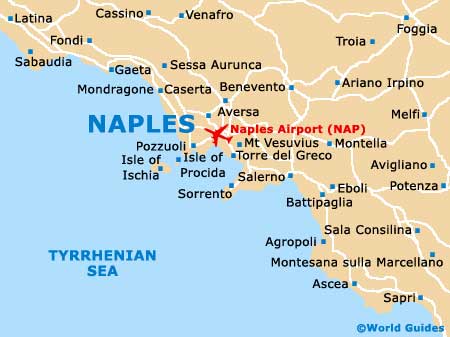
Sited in Southern Italy, the city of Naples lies within the Campania region, between the Phlegraean Fields and the famous active volcano, Mount Vesuvius. Capital of Campania, Naples is famous for its historical city centre, which is considered the biggest of its kind in the whole of Europe.
Naples stands alongside a scenic waterfront and is split into a series of districts, known locally as 'quartieri'. The principal railway station is the Stazione Centrale, which is situated close to the Piazza Garibaldi, next to the bus station. Close by, the ancient Spaccanapoli area lies to the west. The Piazza Garibaldi is an especially chaotic part of Naples, with street market traders and frequent traffic congestion, while by night, this area becomes something of a red-light district.
Maps and Orientation of the City
Bordering the southerly side of the Spaccanapoli area is the Corso Umberto - a notable shopping street connecting the Piazza Garibaldi and the Piazza Bovio. From the Piazza Bovio, the impressive Piazza Municipio is just a short stroll away, along the Via A Depretis, where the Castel Nuovo are the Palazzo Reale are the main highlights. Other notable areas of Naples include the Via Roma and its plentiful artisans, the Via San Biagio dei Librai, Mergellina, Santa Lucia and Vomero, where the bayfront views lead the eye all the way to Mount Vesuvius.
For maps and tourist information in central Naples, the Piazza dei Martriri should be your first port of call.
- Arzano - 10 km / 6 miles (20 minutes, north)
- Casalnuovo di Napoli - 17 km / 11 miles (25 minutes, north-east)
- Giugliano in Campania - 13 km / 8 miles (25 minutes, north-west)
- Lusciano - 21 km / 13 miles (35 minutes, north-west)
- Marano de Napoli - 10 km / 6 miles (20 minutes, north-west)
- Marechiaro - 10 km / 6 miles (20 minutes, south-west)
- Melito di Napoli - 12 km / 7 miles (20 minutes, north)
- Portici - 9 km / 6 miles (15 minutes, south-east)
- Pozzuoli - 21 km / 13 miles (35 minutes, west)
- Quarto - 24 km / 15 miles (40 minutes, north-west)
- San Giorgio a Cremano - 8 km / 5 miles (15 minutes, east)
- San Giovanni a Teduccio - 6 km / 4 miles (ten minutes, east)
- Sant' Anastasia - 17 km / 11 miles (30 minutes, east)
- Torre del Greco - 13 km / 8 miles (25 minutes, south-east)
Map of Italy

Map of Naples